Air Pollution: A Global Problem
Developing technologies to plan for high-pollution days
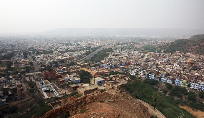
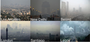
Air pollution is a major global environmental risk to our health and food security. It is estimated to cause about 3.7 million premature deaths worldwide and destroys enough crops to feed millions of people every year.
I durst not laugh for fear of opening my lips and receiving the bad air.
- William Shakespeare
Health officials, the general public and farmers need advance notice when dangerous air quality levels are on the rise. Researchers and engineers at the National Center for Atmospheric Research (NCAR), in collaboration with other agencies, are dedicated to developing new technologies that directly help decision-makers plan for high-pollution days.
This work allows meteorologists and local planners to:
- Forecast air quality for cities and rural areas days in advance.
- Project impact of future changes in human activities and climate on air quality.
- Quantify cross-border transport of air pollution.
- Quantify regional transport of air pollutants within a country.
- Assess societal impacts of air pollution.
- Improve emission estimates.
An Advanced Air-Quality Forecasting System
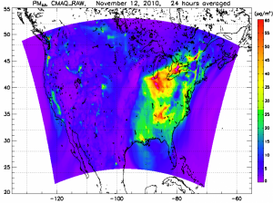
Current air-quality forecasts are limited. They provide a simple single-value prediction and do not specify the uncertainty associated with the prediction. They also simplistically tell whether ozone levels will be high or low. Much more detail in the forecast is needed, and, with funding from NASA, NCAR and its partners are developing a new capability to produce 48-hour detailed forecasts of ground level ozone and fine particulate matter.
NCAR has more than two decades of experience in developing advanced community models that are widely used for air quality prediction and research.
This new forecasting capability combines satellite and in situ observations with state-of-the-art modeling and will generate air quality forecasts in fine detail. Just as a weather forecast, for example, might warn of an 80% chance of rain in the afternoon, new air quality forecasts might warn of an 80% chance of high ozone levels during certain times of the day. Such improved forecasts will significantly enhance the decision-making activity in air quality management. This system is being set up over the USA but can be easily applied to any part of the world.
Projection of Future Air Quality
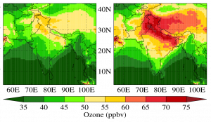
To quantify future changes in air quality due to changes in future climate and human activities, NCAR has developed a global and regional climate model coupled with chemistry. These models can be used to examine the impact of different emission scenarios on the air quality of any region of the world. They have been used to predict changes in air quality over the USA and India as far out as mid-century (2050).
The model results show that Representative Concentration Pathway (RCP) 8.5 anthropogenic emission scenario can improve the air quality in the USA but not in India.
Quantifying Cross-Border Transport of Pollutants
Depending on the lifetime of the particulate, air pollutants can be transported by atmospheric winds from one country to another. Thus, it becomes very important to quantify the contribution of such cross-border transport while designing air pollution mitigation strategies.
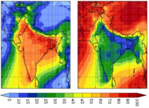
NCAR has developed a tagged tracer technique to quantify the cross-border contribution to both gaseous (carbon monoxide, CO) and aerosol (black carbon, BC) pollutants. Using this technique, the cross-border transport is estimated to contribute up to 30% to wintertime CO pollution but less than 5% to BC pollution in India, indicating that India needs to partner with neighboring countries to reduce carbon monoxide pollution. However, it also reveals that the country can control black carbon pollution.
Working to develop new technologies that directly help decision-makers plan for high-pollution days.
Quantifying Regional Transport of Pollutants
Just like the cross-border transport, it is also important to quantify the contribution of regional transport (defined as emissions from all regions of the country excluding that region) to air quality of a region of the country in order to design mitigation strategies. The contribution of regional transport to CO and BC pollution in different regions of South Asia has been quantified using the tagged tracer technique.
Working to develop new technologies that directly help decision-makers plan for high-pollution days.
Assessing Societal Impacts of Air Pollution
NCAR and its partners have coupled the chemistry transport models with agricultural production and population datasets to assess the impacts of air pollution on human health and crops. For the Indian region, it has been estimated that surface ozone pollution destroys enough food to feed about 94 million people and along with fine particulate matter can lead to about 0.9 million premature deaths every year. The economic damage associated with the health and crop impacts of air pollution in India are estimated to be more than 2 billion USD.
Improving Emission Estimates
Current global and regional bottom-up emission estimates are available to assess the effect of human activities on air quality. However these emission estimates are highly uncertain over some regions of the world. To reduce uncertainty in these emission estimates, NCAR has developed inverse modeling algorithms that combine chemistry transport models with in situ and satellite observations of pollutants to constrain the emissions.
