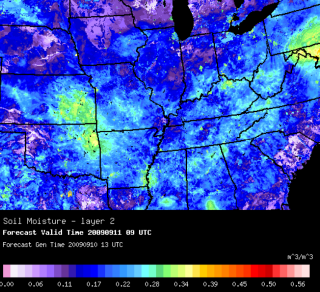
Soil Condition Analysis & Prediction
A High-Resolution Land-Data Assimilation System (HRLDAS) was developed at NCAR/RAL to provide analysis and prediction of high-resolution soil and vegetation conditions. The advantage of HRLDAS is its use of 1-km-resolution land-cover, soil-texture maps and terrain heights, and 4-km rainfall data. Because of this high-resolution aptitude, it can capture fine-scale heterogeneity at the surface and in the soil.
RAL has been collaborating with industry sectors to develop agricultural decision-support capabilities that optimize the timing of pesticide application and irrigation. These projects typically utilize advanced weather and land-surface models and intelligent data-fusion technologies that continuously optimizes the weather and soil predictions. This research has led to improvements in HRLDAS, the Dynamic, Integrated Forecast System (DICast®), and the Noah Land Surface Model (LSM). This research is instrumental in providing critical input to the weather and land-surface modeling, and satellite communities, and comprises a cross-disciplinary effort. Continued work in this area will lead to more precise prediction of weather and soil condition and more efficient and profitable agricultural operations.
