WRF-Urban Modeling
Enhancing the WRF-urban modeling system and its applications to real-time weather forecasts for mega cities
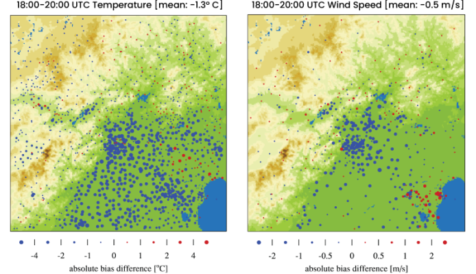
18 – 20Z absolute bias difference in two-meter temperature (a) and ten-meter wind speed (b) between a simulation using BEP with reduced parameter table and the operational 1 km IUM setup. Blue (negative) indicates AWS sites where bias improved; red (positive) where bias degrades.
Global population has become increasingly urbanized: to date 52% of the world’s population live in cities, and this proportion is projected to increase to 67% by 2050. Urbanization modifies surface energy and water budgets, and has significant impacts on local and regional hydroclimate. In recent decades, a number of urban canopy models (UCM) have been developed and implemented into the WRF model to capture urban land-surface processes, but those UCMs were coupled to the simple Noah LSM. We recently couple the more advanced Noah-MP LSM to WRF-Urban as well as to the urbanized high-resolution land data assimilation system (u-HRLDAS). This new modeling capability was tested over Phoenix and Beijing metro areas and will be released in WRF in 2017.